Thursday, February 23, 2006

Column 15: thunderstorms, part 1

Spring is coming. That means that thunderstorm season is just around the corner.

I thought now would be as good a time as any to get back to basics and discuss thunderstorms. This column will be the first of an I-don't-know-how-many-part series on thunderstorms.

Today we'll concentrate on the different types of storms. The thunderstorm spectrum, if you will. And for our purposes here, I'm mainly going to talk about surface-based thunderstorms.

Let's start off with the single-cell thunderstorm.
A bubble of air (hereafter called a "parcel") rises because of a local enhancement of moisture or heat, and it keeps going as long as it's less dense (usually warmer, but this can also mean more moist) than the surrounding air. On its way up the parcel encounters very little wind. Eventually the air cools and condensation starts to occur. When this occurs, rain drops (or their frozen precursors) start to form, which then fall downwards. Still, because of little wind throughout the layer, the raindrops fall through the rising air (called the "updraft"), thereby negating and eventually erasing its effect. This process usually takes about an hour. This kind of storm is called may things: an air mass thunderstorm, a garden variety thunderstorm, a pop-up thunderstorm, a popcorn thunderstorm... They can occasionally cause brief (VERY brief!) severe weather, but usually it's just a little bit of rain and a wind gust to 40 km/h.

Then there's the multicell thunderstorm.
The same air parcel rises upwards, but this time it encounters a little bit of wind on its way up, and let's assume that the wind increases throughout the parcel's ascent. (Until it hits the tropopause or ends being warmer than its surroundings, that is.) The first effect of this is then to make sure that the rain doesn't squash the updraft. But still, what goes up must come down. So you get the rain and wind moving downward, separate from the updraft, in what's called a downdraft.
Where this downdraft falls, it's usually cooler than the air that's in place, so it acts as a wedge, lifting up more surface parcels. These newly-lifted parcels form new thunderstorms, which also don't rain themselves out. So rather than one storm, you get a cluster or line of storms.
Multicell thunderstorms can be severe. The 2 main types (or at least the main 2 I can think of right now) of severe multicell storms are bow echoes and mesoscale convective complexes (MCCs). These storms arise usually if the low-level wind shear is great enough (bow echo--a prolific damaging wind-maker), or if there's copious lift from a low-level jet lifting moist air over a warm front (MCC--a copious rainmaker).

Finally, we get to everyone's favourite, the supercell thunderstorm.
Supercell thunderstorms occur in environments where the wind speed (and direction) change, wind shear, is large enough to cause something very interesting to happen.
Picture an environment where the wind is from east to west at the surface at 20 km/h. Then let's say that it changes suddenly to being west to east, 20 km/h, at 1 km above the surface. Right at the change, if you put a giant windmill there, what would happen? The wind from west to east (above) and the wind from east to west (below) would combine to make the windmill spin. Well, this is what sets up when you have enough wind shear. Except instead of a windmill spinning, it's giant rolls of air spinning on their sides, sort of like a pencil rolling on a table.
Well, take that (pencil on a table) horizontal roll, and blast an upward-moving air parcel into it. The spin keeps going; it's just had its orientation changed, though, so that instead of rolling on a table, the pencil is now spinning like a figure skater. Keep this rotation going through the air parcel's upward motion, and you have a rotating thunderstorm: a supercell.
Supercells are special in that this rotation causes a bunch of really theoretical science-y stuff to happen. Because of this, the updraft and downdraft are not only separated, but they stay close together. This causes the downdraft air to be ingested back into the updraft, causing a steady-state system, one that can last for hours on end. As well, the science-y stuff actually enhances the speed of the updraft, making the storm stronger.
Supercells cause the majority of severe weather caused by thunderstorms. Anytime you see large hail (that's nickel-sized and larger), in all likelihood it has been caused by a supercell. If you see a strong tornado, it was definitely caused by a supercell.
(I'd go into how tornadoes form here, but it's a column unto itself. I'll try to remember to write it sooner rather than later.)

Every thunderstorm is different. You're likely to see not a supercell, but a multicell that acquired sufficient rotation and then the complex morphed into a supercell. Or a supercell that tapped copious low-level shear and changed to a bow echo.
Seeing the classic type of storm is a rare occasion unto itself.

Having a general understanding of what you're looking at gives you a better idea, then, of what type of weather to expect.
Tuesday, February 21, 2006

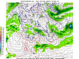
big storm friday?

well the models have been more or less agreeing for the past couple of days that there's going to be a pretty good low pressure system affecting the northern plains or southern prairies on friday. the question is where.

currently the gfs and gem global both have winnipeg getting a pretty good dump of snow along with strong winds--near-blizzard conditions.

the nam has the storm much weaker and far off to our south.

so be prepared. this one could be nasty, or it could be a nice day.

here's the gfs valid friday evening.


Monday, February 20, 2006

new co-webmaster?

i'm currently in negotiations (of sorts) to get a co-webmaster for weather central.

i've been getting busier and busier in my personal life and right now the site has taken on a more "routine maintenance" part in my life.

this needs to change, as there is some file cleanup that needs to be done and new menu formatting that will make things a lot neater.

so if and when it becomes official, the new co-webmaster will be announced right here, as well as on the crawler at weather central. and he might even blog here, too.

if you have any recommendations about the site, as well, let me know. i'm always looking for improvements.

oh and by the way there's a new animation of a trough/cold front passage on the science page. go check it out. it's cool.

Wednesday, February 15, 2006

coredumping and bitter cold

sorry about coredumping all those columns here. i just had a bunch of time and knew that if i didn't do it all at once, i'd procrastinate and not get it done at all. so don't worry. my next couple of columns there have to do with wine, not appropriate for this blog, so they won't be put here.

the cold weather is here. today i think we'll maybe get up to -16. tonight we're looking at -30 or so, and tomorrow we probably won't make it out of the minus 20s.

then comes thursday night.

right now the official forecast is calling for -37 thursday night. wow. my meteorological spidey sense tells me that it won't be quite as cold as that, but i've been known to be wrong before. right now i'd say -34. which is plenty cold anyhow.

what's going to keep the temperature up? the wind.

and that's where we have to be careful. i plugged some of the forecast numbers into a calculator and it seems the wind chill on friday morning could end up being in the frightening range, somewhere in the -45 range.

whatever number the temperature turns out to be, keep warm on friday morning. i have the luxury of not having to go anywhere, so i can stay all snug and warm in my house. others aren't so lucky.

Sunday, February 12, 2006

Column 14: A day in the life (originally posted January 13, 2006)

I was asked to write a column about a "day in the life" of a meteorologist.
Good topic idea! For the purposes of this column, I'll write about a typical 12-hour day shift, as there are obviously aberrations. And boy, can they be crazy. (And usually fun, too!)

I was asked to write a column about a "day in the life" of a meteorologist.
Thanks, Rain! Good topic idea! For the purposes of this column, I'll write about a typical 12-hour day shift, as there are obviously aberrations. And boy, can they be crazy. (And usually fun, too!)

Here's a tour of our office!

Before I walk in the door, I make sure to have my fuel at hand--for me it's an extra large from Timmy's.

The shift change briefing is meant to be an overview of the goings on, areas of concern, and potential problems. The outgoing shift usually gives a 5- to 10-minute description of the overall meteorological pattern and any diversions from this pattern that might not be obvious--an unexpected wind, a temperature higher than expected, things like that.

After the briefing but before starting anything else, I have to make sure the current forecasts aren't "broken". That is, that no unforecast weather is occurring. This is pretty rare, but once in a while it happens. If an amendment is needed, that's when I do this.

Then I sit down and roll up my sleeves. Literally.

As you might know if you've read any of my columns, I'm a giant proponent of analysis, diagnosis, and prognosis. This isn't a trivial set of tasks.

I print out the unanalyzed upper air observations plotted on a map of most of North America, at 250, 500, 700, 850, and 925 mb. On all of them I contour the heights, which are analogous to pressure. On the 250 mb chart, in addition, I analyze the jet streams and streaks. On 500 and 700 mb, I analyze the temperatures. At 850 and 925 mb, I analyze the wet bulb potential temperature--this is a much better field to analyze at this level for frontal analysis than simply temperature. After those are done, then, the surface analysis follows.

Once I'm done all the chart analyses, I bring up the individual soundings around the region and nearby, looking for features that will give me clues to possible weather for the day. For example, in the summer, I'll look for potential instability. In the winter I'll look for freezing rain potential and snowmaking layers.

That's the analysis done.

Next, I look at my satellite images and RADAR composites. I compare those against my upper chart analyses to try explaining to myself and my colleagues why the weather is doing what it is, have a discussion with them about all that. This is really where the University training comes in--you have to be able to instantly recall meteorological theory and have all sorts of conceptual models at the tip of your brain. Usually, the situation is atypical, so you have to construct a hybrid conceptual model of what the atmosphere is doing that day. The RADAR and satellite imagery will also sometimes fine tune the analysis. Once I've finished justifying why the weather is doing what it's doing, the diagnosis is done. And now it's time to move onto prognosis.

Prognosis is something on which entire University courses are given. I use all sorts of techniques I won't go into here to forecast the future evolution of the different elements of weather--cloud, precipitation, wind, and temperature. One thing I will point out, however, is that in the first 12 hours of my forecast period, I ignore the forecast models.

Say what?

Yes, I ignore the models. There are 2 main reasons I do this: first off, it has been shown that, in the first 12 hours of its valid period, a forecast model is horrible. Secondly, even when a forecast model is past its first 12 hours, it still does fairly poorly (in non-benign situations) in the lowest 1 km or so of the atmosphere. Shock of shocks, that's where most of us live! (Although many of my friends would say I always have my head in the clouds, but I digress.)

Okay, so I've done my analysis, diagnosis, and prognosis. It has taken me anywhere between 1 (relatively easy day) and 2 and a half hours (complex day). What comes next? I have to put out forecasts--the morning updates.

Putting out the forecasts is the easiest part of the job, because all of the "work" (i.e. the meteorology) is done. The software we use allows me to modify every important weather element (sky condition, precipitation, POP, wind, temperature, etc.) and then at the press of a button ... it produces the worded forecast! Awesome thing, this technology!

Once the morning updates are done, it's time for lunch. A half hour to 45 minutes is good, and then I come back to start on my midday analysis.

It's only a surface analysis this time, because the upper air observations only come twice a day. But it's still important, especially if satellite and RADAR have indicated something that I hadn't seen with the morning analyses.

Anyhow, the afternoon is pretty much the same--I redraw the mental picture of what the state of the atmosphere is, and put together the forecasts for the afternoon update.

After the afternoon update is done, it's time to sit back and maintain a "weather watch". That's code for checking to make sure my forecasts stay valid.

In the summer, of course, if there are storms brewing, I'll be involved with that--either with interpreting RADAR, calling weather watchers, or issuing watches and warnings. And there are other things to do once in a while--a radio or TV interview, but mostly the day is spent in our insular society of an office.

This rounds out the rest of the day until the night shift comes in. I give them their briefing and my day is done!

I hope this has given you a glimpse into what we do. If you have any questions about what we do, don't hesitate to ask!

Column 13: White Juan (originally posted January 4, 2006)

On February 18-19, 2004, a most memorable winter storm smacked the east coast, giving unconfirmed reports of almost 100 cm of snow to the Halifax area. Almost everything shut down; everything being covered in snow that sometimes flew sideways because of the 60 to 80 km/h winds.
"White Juan", so named because of the actual Hurricane Juan which had hit the same area barely 5 months prior, is the stuff of legends.

Why, though, did it happen this way? Why was it so severe? Why did it have so much snow in it? I will attempt to answer these questions in this column.

Whenever gauging the amount of snowfall, we consider the snowfall rate and duration. In this storm, the snowfall rate wasn't atypical--3 to 4 cm/hour, which I personally have seen in Halifax. In some storms, the snowfall rate has been reported as high as 8 to 10 cm/hour. (In snowsuqalls off the Great Lakes, snowfall rates can also approach 10 cm/hour, but that's another column.)
In this storm, then, the key wasn't the snowfall rate but the duration. As outlined below, the regular snowfall rates persisted over a much longer time, leading to this most impressive snowfall.

To start off the heavy snowfall, White Juan bombed. A meteorological "bomb" is defined as a storm that deepens by 24 mb in a 24-hour period. This storm did that and more, bombing from 996 mb to 959 mb in 24 hours, a drop of 37 mb. Whenever a storm experiences such deepening, it is always accompanied by very strong upward motion and, as a result, heavy precipitation.
Conveniently, this storm bombed at about the time when the upper low (500 mb) was pretty much collocated with the surface low. Whenever this happens, the surface low is said to be "captured" and its forward speed slows to a crawl. If this happens during a heavy snowfall rate, then the heavy snow happens over a longer-than-normaal timeframe.

The actual meteorological conditions forming this storm weren't all that uncommon: because of the Gulf Stream off the coast and a relatively cold airmass on the continent, a semi-permanent baroclinic zone (front) was set up. Because of the availability of the Gulf Stream, moisture was copious. All that was needed was a disturbance in the upper atmosphere to act on the surface front, and a low pressure system would be born, just off the coast of Cape Hatteras. This upper disturbance came about in mid-February, perhaps a little deeper than usual, inducing explosive deepening of the surface low.
As per most conceptual models of such systems, moisture was streamed northward ahead of the system, gradually being lifted, causing cloud and precipitation. Because of the cold air at the surface, the precipitation fell as snow (and freezing rain and ice pellets.)
The generally accepted swath of heaviest snow in a "Cape Hatteras Low" is a specific distance northwest of the surface low, a distance I can't recall and was unable to find in my research for this column. But suffice it to say that the optimal distance was reached; add in that the storm was bombing as it approached, inducing heavy snowfall, and the fact that it got captured as it was at this optimal distance, and you have the setup for an abnormally heavy snowfall.

Snowfalls of (kind of) this type are not uncommon over the east coast. Usually one or two storms per year have snowfalls in the 30 to 50 cm range. What made this one different was the fact that, at the height of the storm, it slowed its forward movement, putting Halifax in the area of heaviest snowfall for 24 to 30 hours, instead of the usual 6 to 12.

I love snow. I only wish I had been in Halifax at the time, so I could have taken in this storm.

For more information about this storm, check out Chris Fogarty's storm summary at this link or Environment Canada's summary at this link.

Column 12: Winter storms (originally posted December 1, 2005)

Stefan from North American Met suggested a column about this, and I think it's a great idea: what happens in winter weather systems. Specifically, the suggestion was for me to discuss precipitation regimes and locations.

Well, the main thing to consider when talking about any weather system, be it a supercell thunderstorm, a hurricane, or whatever, is the airflow within the system. A large-scale winter weather system is made up of air and stuff (water, cloud condensation nuclei, all sorts!) moving up and down and all around in a seemingly chaotic yet surprisingly ordered fashion.

Warm moist air is moving into the system from the south, and cold dry air is moving into it from the north. See this link for a discussion about that--it's essentially the Norwegian cyclone model. Click here.

The warm air moves parallel to the ground until it hits more dense air--the interface of these 2 airmasses being a (warm) front. The warm air rides up over the cold air, and at the mixing zone the moisture in the warm air is cooled to or below its dewpoint, causing cloud and precipitation.

At the cold front, the opposite is happening. The cold air is moving southward, and when it meets the warm air at the interface between the two (aka the cold front), it forces the less dense warm air to rise. As the warm air does so, much like at the warm front, it mixes, cools and condenses, causing precipitation.

The airflow is obviously more complex than this, but going into the entire flow regime is almost a University-level course itself. Let's just say that warm air from the south moves north, rises at the cold front, and eventually turns eastward with the jet stream. Cool-ish air north of the warm front moves westward, parallel to the front, rises gradually and is eventually turned eastward by the jet stream. Cold air essentially moves southward, "wedging" the warm air upward.

There are many factors influencing what kind and how heavy the precipitation will be. These things include 1) surface convergence, 2) moisture content of the air, 3) upper support, and 4) instability.

Surface convergence is an obvious choice because it means air coming together. When air comes together, such as at a front, the excess mass has to go somewhere. Now unless there's a giant vacuum hole in the ground, physics says that the air must rise. So logically we can expect precipitation to be enhanced near fronts.

The moisture content of the airmass is of course a no-brainer. The more moisture you have available to condense, the more moisture you can put on the ground in the form of precipitation.

Upper support is a more nebulous thing to gauge, until you've seen it in action a few times. Examples of upper support include increasing vorticity (translating to increasing lift) aloft and my personal favourite, the divergence at the left exit region of a jet stream. (The latter is something I personally call the "sweet spot" when it comes to winter precipitation--I've seen 5 to 7 cm of snow per hour fall from the sweet spot in the maritimes--most notably St. John's. But here in southern Manitoba, it can even be a pretty sweet spot--dumping 2 to 3 cm every hour, a pretty crazy snowfall rate for here.)

And instability can of course increase precipitation rates. If your air has a tendency to rise without prompting, well, it's going to have a better chance of condensing all that moisture it's involving.

Where, then, do we get the heaviest precipitation from a winter storm? Well, it seems the juxtaposition of the 4 factors mentioned above is where it happens. In this example, you can see on the satellite picture where they came together over southern Manitoba: there were fronts in the regoin; copious moisture was being advected from the Gulf of Mexico; vorticity was increasing aloft along with the sweet spot being over us; and there was just enough cold air aloft and heat/moisture at the surface to make the atmosphere unstable.
Here's the satellite example.

So now we've figured out the areas of heaviest precipitation. But what kind will the precipitation be?

When diagnosing precipitation type, we usually employ a top-down approach: that is, we do a thought experiment where we follow a precipitation particle from birth way up in the clouds to its impact at the ground.

To produce precipitation particles in the cold rain process (for the nerds out there, this is known as the Bergeron-Findeisen process) you need temperatures between -10 and -20 C and saturation. And of course, cloud condensation nuclei. These ingredients produce both ice crystals and supercooled water droplets. The supercooled droplets freeze on impact with the ice crystals, making them grow so that they eventually become large enough to fall.
When these ice crystals/now snowflakes are falling, they fall through all sorts of regimes. It is what the snowflakes encounter that ultimately determine the precipitation type.

If the snowflakes fall into a layer of above-freezing air that extends to the surface, the precipitation reaches the ground as rain (or wet snow if the above-freezing layer is sufficiently shallow).
If the snowflakes fall and hit the ground without encountering above-freezing temperatures, then obviously you have snow.
If the snowflakes fall through an above-freezing layer but then fall through a layer of sub-freezing temperatures close to the ground, the precipitation type depends on the thickness of the above-freezing layer and the thickness of the below-freezing layer. You can thus surmise that if the above-freezing layer is relatively thick and the below-freezing layer is relatively thin, freezing rain is most likely. If the opposite is true, ice pellets (known in the USA as sleet) are most likely. In between is one of the great forecast challenges in the winter. And what makes forecasting precipitation type fun.

In winter storms, the most likely place for freezing rain and/or ice pellets is just north of the warm front. You have cold air at the surface, and the warmer air has risen to above the surface: perfect conditions to melt and re-freeze the precipitation particles. In some rare cases, freezing rain and ice pellets can happen behind a cold front, but it's not a common thing.

So ends a long explanation of precipitation in winter storms.

Column 11: Weather myths (originally opsted November 1, 2005)

We all know that weather story, the one that we know isn't true but we keep hearing it be perpetuated. You know which one I mean.

Well, I think it's high time we debunked the myths of the weather variety.

I'll start off this thread with a couple of well-used myths, and then hopefully you'll come up with some (or ask about something!)

1. The Canadian prairies are dry dry dry.
Fact is, the Canadian prairies, at least in summer, can be as humid as or more humid than southern Ontario! In mid-summer, the typical hot-and-humid temperature/dewpoint combination in Toronto is 30/20. Pretty steamy, producing a humidex of 37. Well, in (especially the eastern) prairies, it gets like that every summer. It may not last as long, but visit Winnipeg from mid-June to mid-August, and don't be surprised to see 30/20 there. Further, the most humid reading I've ever seen in Canada happened in Manitoba. 34/27. Yuck.

2. "It's too cold to snow".
orry, folks, but this one is a bald-faced lie. It's nestled within a grain of truth, though, which has been milled to produce mythical flour. When the temperature is -30 or colder, the air, even if saturated, is very very dry. Cold of this type is not conducive to the production of ice crystals, which are what start off snowflake formation. However, the problem is this: air that cold is extremely dense. Almost always, air this cold is also in a layer only a couple of hundred metres thick, and above it is much warmer air. The problem is that the density of the cold air makes it hug the ground, where we live, and force us to wear ridiculous poofy clothing.

So even though it may be very cold at the surface, aloft it may be warm enough--right in that perfect temperature range to promote ice nucleation and snow production.


3. The Coriolis force makes tornadoes mainly spin counterclockwise in the northern hemisphere
Nope, nope, nope. At least not directly. The Coriolis force acts on length scales of the order of continents, not the order of metres. The amount of Coriolis deflection of air inside a tornado is so small (less than a millimetre) as to be considered zero.

So what's going on then? It's called cyclostrophic balance--the balance between the pressure gradient force (that's why a tornado is so windy) and the centrifugal force.

There is a caveat, however. The Coriolis force does act on low-pressure systems, making the wind blow counterclockwise around them (in the northern hemisphere). This large-scale wind flow is generally needed for tornadoes to form in the first place, so it can be said that the Coriolis force has an impact on tornado formation. Just not in the way that most people think.

As an aside, in a likewise manner, toilets do not flush counterclockwise nor do sinks drain counterclockwise because of the Coriolis force. The direction of swirl is entirely dependent on the motion imparted on the fluid being drained in the first place. Don't believe me? Pull the plug on a full sink, but just before you do, make a slow clockwise circle with your hand in the water. See what ensues.


4. Lightning never strikes the same place twice.
Tell that to the CN tower.
Although, in one sense, this is true. The Earth is spinning through space on an orbit on an orbit (earth spins, revolving around the sun, which is revolving on a spiral arm around a central point in the galaxy). This means that, in true space, lightning likely doesn't strike the same place twice, even if it does. But that's just a bit more philosophical than I need to get here.


5. A green cloud predicts a tornado
This one was helped along by that guy in Twister. "Going green" is what I think he said. Green hues in a cloud merely tell that the cloud has copious water involved in it, so it's absorbing most of the light given to it. It indicates the likelihood of heavy rain, and can sometimes mean an enhanced risk for hail. but a green sky in itself means nothing for tornado formation.

I could go on and on, but then that would take the fun out of it. Go nuts and let me know about some weather myths you've encountered!

Column 10: What got me into weather...and what got you? (originally posted October 25, 2005)

As Wilma's remnants move past the southern Maritimes, I'm sitting here in awe of Mother Nature. I also found myself thinking that I'd like to write a column but don't have any inspiration.

Then I got to thinking about the job I have (as a meteorologist)--how much I love it, and how I sometimes lose my enthusiasm. And how I get back that enthusiasm: I remember why I got into this business in the first place.

So now it's story time. I hope when I'm finished, I can read your stories. I always find it interesting to hear how other weather weenies came upon their passion. (Addiction? Obsession?)

My grandparents lived outside of the town of Wynyard, Saskatchewan. It's a town of about 2000 people in the east-central area of the province, one which processes a huge amount of poultry. Chances are if you've eaten chicken in western Canada in the last 20 years, you've had chicken that was processed in Wynyard.

But I digress.

Where was I, anyway? Oh yeah. Every summer when I was growing up, our summer vacation would be to go out to the farm for a month. This was great, as it afforded myself and my 2 brothers to hang out with our cousins, who lived just outside of Toronto. We got to see how the other half lived.

So one summer, it was the summer of 1984, was special. Wynyard had just opened up its brand new outdoor swimming pool. (Previously, if we wanted to go swimming, we would have to go to Foam Lake.) Well, this one particular day was extremely hot and humid, so we wanted to go swimming. After lunch, the parents said.

After lunch, when the dishes were (finally) done up, myself and my 2 brothers, along with 2 of our cousins and our uncle, piled into the car, on our way to the Wynyard swimming pool.

Now, let me explain a bit better about how hot it was. Even 21 years later, I can still feel the heat baking my skin, as well as the oppressiveness that I didn't know how to describe at the time but I know know as high humidity. I can feel that clammy, uncomfortable warmth and estimate that the temperature and dewpoint were about 32 and 19. Pretty humid for Saskatchewan, but not overly so.

Again with the digressions, Dave.

We were driving north, on our way. Those puffy cumulus clouds were all around, creating the perfect (so it seemed) Saskatchewan summer day. Until it suddenly (it seemed) started to rain.

It seems we came upon a fairly vigourous cumulus, one that had grown into a cumulonimbus. There was very soon extremely heavy rain and lots of lightning.

But then something started to happen.

There was something else mixed in with the rain, and it was making splats on the window. Small hail.

Well, the "small" part didn't last for long. The small hail soon turned into medium-sized hail and then large hail, ending up about the size of golf balls.

And then it stopped.

Suddenly.

It didn't taper off, like you'd usually expect. In the matter of a second, it went from golf balls pinging off the windshield to eerie calm.

That's when I saw it.

I looked out the window I was next to (on the left side), and saw something I will carry with me for the rest of my life: a funnel cloud.

When I say "funnel cloud" I mean it. This looked very much like a funnel--an inverted traffic cone, if you prefer. The main cloud base was about 2000 feet off the ground, and this protrusion extended about halfway from the main cloud base to the ground.

I sat there, transfixed, staring, in awe, almost inside myself. I now think that if someone had hit me, I barely would have noticed.

This scene didn't last for very long--maybe a minute. My uncle had seen what I had seen and floored the accelerator, albeit to no avail--the heavy rain and hail had turned the gravel road into a mud pit, and he only succeeded in making us fishtail a bit. But we were moving quickly enough that we were back in the hail inside a minute.

The hail did, once again, start, as big as it had been before. Then it got a bit smaller, and smaller, and smaller still, until it was indistinguishable from the rain. The rain then gradually let up and soon enough we were back under blazing sun, the only inklings of what we had just gone through being the dark cloud with the occasional lightning stroke extending downward from it, and the attendant lightning static on the (AM) radio.

We got to town about 20 minutes later but you could have fooled me. I didn't notice anything for the rest of the trip. I've heard this description about many things and I think it suits the situation nicely: it felt like a tactical nuke had been dropped on my head.

I never did end up going swimming that day. When we got to the pool I said as much. My uncle, who didn't (and doesn't, so far as I know) swim, was going to stay in the car so I decided to hang out with him. He asked why I now didn't want to go, and I think I gave him some cock-and-bull story about not wanting to get hit by lightning while swimming. That seemed to satisfy him and he didn't ask me about it again.

That was a lie, of course.

I sat in that car with my uncle, quiet as a mouse. You would be, too, if at the age of 9 you had figured out what your life's passion and career would be.

I had much more important things to think about than swimming.

Column 9: Tornado warnings for bow echo storms (originally posted October 17, 2005)

I have been very actively watching warning trends in the United States for 3 years now, and one thing they do baffles me somewhat:
They issue tornado warnings for bow echo severe thunderstorms.

Now, bow echoes are very serious things. They tend to cause widespread wind damage, and the winds in them can reach upwards of 200 km/h, into F2 territory.

But if there's likely no tornado involved and no report of such, why do some offices issue such warnings? I just came back from a conference where they explained one reason, thereby confirming one of my hunches, but I have four.

First off, a lot of warnings are semi-automatically issued based on RADAR algorithms. While useful, I find these algorithms are, at best, hints that the meteorologist should look into something more closely. Bow echoes have a tendency to produce what's called a tornadic vortex signature, or TVS, on many US RADARs. The reason is this: the TVS, among other things, looks for a certain amount of pixel to pixel (aka gate to gate) wind shear or difference in the storm-relative velocity output. In other words, it looks for strong storm-relative winds toward a storm, along with strong storm-relative winds away from the storm. Or, alternatively, it looks for a large difference between the winds toward and away from a storm. And this is where the trouble comes in with the algorithm.

An example of this phenomenon is at this page, which shows the storm-relative "rotation" in the RADAR loops. Now, for the record, I don't recall and can't figure out how to find out if a tornado warning was issued for this storm, but you get the idea.

My second hunch is that they issue tornado warnings for such storms based on the conceptual model of such a storm. In a bow echo, you often have a very narrow channel of strong winds. This, of course, induces strong rotation--especially if the surrounding air is relatively calm. To see this idea in action, all you have to do is swoosh your hand through calm water, and notice the eddies that form.

The third idea I have on why they issue tornado warnings for bow echoes is this: the winds can sometimes be so strong that they can cause tornado-like damage. Like I mentioned before, wind speeds can sometimes reach upwards of 200 km/h, so if your roof is ripped off, you don't care whether it was caused by a tornado or by straight-line winds--you just care about your now-unattached roof. (Although apparently, for some reason, insurance companies seem to care whether it was straight-line wind or a tornado, but I don't see why--in both cases, it was wind!) The problem with this idea, though, is that people become less convinced, then, that straight-line winds can cause such severe damage--hence the oft-heard exclamation "it must have been a tornado".

Finally, the fourth possible reason is that there's some reluctance to switch mindsets when you're in warning mode. Often a storm will start as a supercell, possibly producing tornadoes. One of the normal transitions of a supercell is for it to become a bow echo. When you've been issuing tornado warnings for a storm, it becomes difficult sometimes to recognize that it has made such a transition, despite all the RADAR signatures to the contrary. It's a psychological barrier, if you will.

I suppose when it comes right down to it, it doesn't too much matter what kind of warning gets issued--as long as a warning is issued.

After all, it's what we're there for.

Column 8: Severe thunderstorm forecasting (Originally posted October 6, 2005)

Severe thunderstorm forecasting. It's something I love to do, and something I hope to get better at.

I'm a devout follower of the ingredients-based forecast, as it seems to work out for me so well most of the time. And I'll continue following that tradition.

So what are we looking for when we're forecasting severe thunderstorms? There are 4 main ingredients: moisture, instability, lift, and shear. I'll talk about them all in turn.

First off, you need moisture in the low levels. Moisture is the fuel which feeds thunderstorms. We all remember that muggy summer day when a thunderstorm was welcome, as it came to cool us off. Moisture is measured more or less directly at the surface and aloft, in the form of the dewpoint. I prefer this measure, but some prefer the more nebulous "relative humidity".
How does moisture feed thunderstorms? When air rises, it cools and eventually reaches a point where condensation occurs. When this condensation occurs, heat is released--the heat that went into evaporating the moisture in the first place. This heat is known as latent heat. This latent heat becomes real heat, and warms up the air very near it. As we all know, warm air rises. So moisture in the air leads indirectly to upward motion.

Instability is the next ingredient necessary. Instability is essentially the tendency of the atmosphere to overturn. Usually measured as Convective Available Potential Energy (CAPE) or Lifted Index (LI), the higher the CAPE or the lower the LI, the more instability there is. Essentially this can be thought of as the temperature difference between a parcel of air rising from the surface, and the air already present around it.

Lift is an important ingredient, too. Some people like to use the word "trigger" instead, but I'm more partial to "lift". Lift can be present in many ways: at the surface--a cold front, a warm front, a dryline, an outflow boundary, a seabreeze, a surface trough, and there are others that I'm forgetting. Aloft, the upward motion helpers (not so much triggers, though) are left exit and right entrance of jet streams, vorticity maxima, cold pools aloft, and dry air intrusions aloft.

Finally, we get to wind shear. Wind shear is the ingredient that, without it, even if you have the others, you won't get a long-lived severe thunderstorm. Sure, you may get pulse-y severe storms, but not the beasts that I try to chase. Wind shear comes in 2 forms (that we count): directional and deep-layer. Directional shear is simply the changing of the wind direction with height. Near a warm front, the wind will often be from the east, and as you go higher, the wind will veer to southeast, south, southwest, and finally west. This is directional shear. Deep-layer shear is an arbitrary concept that was developed numerous years ago, but seems to work. It's the vector difference in wind velocity between the surface and 6 km. (Usually we use 500 mb as a proxy for that.) What both of these types of shear do is set things up so that the downdraft (air going down) doesn't fall into the updraft (air going up), essentially cutting off. In other words, shear separates the updraft from the downdraft.
Deep-layer shear is necessary for mid-level thunderstorm rotation, while directional shear (especially in the lowest 1 to 2 km) is ideal for tornado development.

Put these things together, and you can get severe thunderstorms.

But sometimes not. There are numerous things that can come up to destroy your perfectly "good" forecast of severe thunderstorms, leading to chasers getting sunburns and logging thousands of kilometres on their vehicles.

A storm-squasher is subsidence or, more correctly, lack of lift. I've seen a few occasions where things were primed to go, but there was no lifting mechanism in place, so it stayed sunny.
Lack of low-level moisture can sink a forecast, as well--especially if you're using a model forecast (more on model forecasts in a bit) for your storm determination.
Warmer-than-expected air aloft can stop updrafts from going. A parcel of air rises and keeps rising if it's warmer than what's surrounding it. If you have a lot of warm air aloft, having rising air warmer than its surroundings becomes less and less likely.
As well, the warm air aloft can create a "lid" on upward motion in the atmosphere, a temperature inversion. Moisture trapped under this lid, if lifted, can cause a deck of low cloud, not allowing the sun to shine and do its job. Too much cirrus overtop can have much the same effect, although to a lesser degree.
Finally, too **much** wind shear can cause your updrafts to get torn apart before they barely get started. This phenomenon, if you ever see it, is called a "turkey tower". Seriously. The storms trying to go up look like turkey necks.

So now, how does one forecast severe thunderstorm areas, based on model output? Of course, I prefer to forecast up to 12 hours in advance with real data, but after that, short term forecasting techniques don't really work.

Now, all of what I'm about to say is geographically dependent. The numbers I'll give are what a person would use in the plains states. The numbers aren't vastly different for most regions across Canada, but Alberta tends to have some different characteristics and thresholds.

First off, let's look at moisture. Moisture for severe thunderstorms needs to be deep enough that it still serves as fuel. If you have a shallow layer of moisture, it will tend to mix through the depth of the boundary layer once daytime heating and mixing occur, so you need the depth of the mixed layer to be less than or equal to the depth of the moisture. Traditionally we look at the dewpoints at 850 mb and at the surface. 925 mb is optional, too.
Dewpoint thresholds vary upon time of year, but it seems that once surface dewpoints go above 15 degrees C (10 in Alberta) there's likely ample moisture. At 850 mb, we tend to look for dewpoints above 10 degrees.

Instability is something that's related to the moisture in the atmosphere; the more moisture, the more unstable the airmass. So it wouldn't be surprising to find that the areas with the highest dewpoints, according to the model, are the areas most likely to have high instability. When assessing instability, I'll look at Surface Based CAPE (SBCAPE) and Mixed Layer CAPE (MLCAPE). SBCAPEs above 1500 j/kg (1000 in AB) and MLCAPEs above 1000 j/kg seem to be the minimum needed for severe storms, although I have seen less.

Lift is something that can be a bit more difficult to see on the models--especially the lifting mechanisms that are smaller in scope, like seabreezes and outflow boundaries. Fronts, though, can be identified by a tight gradient of the 1000-500 mb thickness pattern, accompanied by a tight temperature gradient at 850 mb. Drylines can be found simply by looking at the surface dewpoints. West of a dryline, the dewpoints tend to dry off by as much as 30 degrees C. (But the thickness pattern won't show any gradient--a sign of no front.)

Wind shear is perhaps most difficult to gauge. I like to simply look at the 500 mb wind and use its speed as a proxy for the 0-6 km shear vector. But in doing so you have to be careful; look at the surface wind direction, as if it's the same direction as the 500 mb wind, then using the 500 mb wind as a proxy for the shear isn't valid. Then you have to do vector differences.
As well, I look at the forecast winds at all given layers--surface, 925, 850, 700, 500, and 250. I then build a mental image of what the winds throughout the atmosphere are doing over any given point.

That's it--no fancy stuff, just plain old looking at information and synthesizing it. I've done this a lot, and I still need practise. In fact, I think I'll **never** stop needing practise. But it sure is fun!

A couple of tidbits to send you off with, and hopefully spark conversation and a few questions:

Cold fronts tend to produce lines of storms. Supercells can be embedded in the lines, but with a cold front it's more likely a squall line will occur.
Warm fronts can be prolific supercell producers. If a storm hugs the front, it can ingest moisture and copious directional shear, and these can go on to produce tornadoes for hours. If a storm crosses the warm front into the cooler air, though, it will still be severe--just producing large hail instead.
Dryline storms are fun to watch. Sometimes all you need to do is park yourself about 50 km east of a dryline and wait for things to go. Tornadic supercells frequently occur with these.
And finally:
Don't put too much credence into model output. What you have in front of you is **an** answer, not **the** answer. Model output is useful for strategic general placement, but for the day of?

I'll take real data any day.

Column 7: What storm chasing is really all about (originally posted October 11, 2005)

When I tell people that one of my hobbies is chasing storms, the response is inevitable:

"Oh, so you're like those crazy people in Twister, eh? How many tornadoes did you see last time you went out? Four? Five?"

"**Sigh**"

I'm penning (okay, pixelling) this column to set the record straight as to what is involved with storm chasing.

First off, before you can even think about going out on the road, you have to understand meteorology, how to forecast and nowcast severe thunderstorms. Just going out there and getting in the way of a storm and trying to get pictures and video is a good way to get yourself in danger. In fact, even the more seasoned storm chasers (that would be myself) can get into trouble when bad decisions and bad luck combine. More on that soon.

Knowing meteorology, like I said, is of utmost importance, for two reasons. First off, you need to be able to forecast (and nowcast) where and when storms are going to develop. Second, once the storms do develop, you need to know what type they're likely to be and how they're going to move.

That's the meteorology part of it. And believe me, it's no minor part!

Then you have to have dedication. Resilience to boredom. A love (ot at least tolerance) of seeing mile upon mile of endless open prairie. And lots of sunscreen.

See, in Twister, the intrepid chasers caught something like 5 tornadoes in a 24-hour period. That's just not realistic.

At least, from a Canadian perspective, it isn't. Sometimes my American friends have a bonanza day and see 5 in a day. But I digress.

I went chasing this summer for a total of about 20 days, each averaging 8 hours of driving--including endless roads, occasional pit stops, mostly fast junk food, and the same CDs over and over. What did I get for my valiant efforts? 4 tornadoes totalling 45 tornado-minutes and a driver's sunburn. Calculating that out, it translates into one half of one percent of the time I was gone dedicated to viewing tornadoes. Obviously, then, it's not all about the tornadoes. If it were, I'd have given up long ago.

It's about communing with nature. It's about viewing the sky in awe, no matter what's there. (And although I only spent a tiny amount of time viewing tornadoes, I spent lots of that time viewing beautiful storms.) It's about seeing parts of the continent you would otherwise not see. It's time away.

Back to the mechanics of it. What would I recommend you do, if you've never been out chasing and want to go?

Rule number one: GO WITH SOMEONE EXPERIENCED! There's nothing better at teaching you the ins and outs of chasing than going with someone who knows what he or she is doing. Everything I've laid out here is more easily picked up if you go with an experienced person. You'll learn what to look for, what to discount, how to read the sky, how to fine tune your target area, what places are good to eat at, how not to act (like parking on the road, even a seemingly deserted road--a HUGE no-no!), and you'll likely get to meet other chasers.

Rule number two: always prepare to change your plans. Split-second decisions can make or break your trip or even prehaps save your life.

[Here's where Dave goes into a sidebar anecdote.]

I was out chasing in southwest Saskatchewan on June 17, 2005, south of Swift Current. Storms were initiating to my south, moving northward, and I was in good position. One storm, in particular, seemed to be the main one at the time. I got into place near the town of Cadillac and watched the main updraft to my west. It spun up a brief tornado and then continued northward. I decided to try getting closer to the storm, as it was running away from me. But I got into rain, and then hail. All of a sudden, the hail got to be about the size of dimes and the wind made a sudden direction change--from southeasterly to northerly. My meteorological training and knowledge of the storm movement that day told me that I was suddenly in a bad region. I turned the car around and got out of there. As I was doing so my phone rang, with one of my colleagues asking if I was all right. I confusedly said I was, although I was having trouble seeing, because it was raining so hard. When I got out of the rain, I saw why she called. A tornado was on the ground, churning up debris in the area I was trying to get to. Had I kept on going, I very well might have been directly in its path.

An American colleague of mine got into similar trouble about a year and a half ago; the only difference was that, instead of dimes, the hail hitting his car was about the size of baseballs. Even scarier than what I had experienced.

So you see, going with someone experienced is a tremendous advantage--it can usually save you from doing something silly and it can point you to the good storms.

Storm chasing isn't as glamourous as the movies would tell you. There are hours of driving and sunburns and bad road food and people sometimes not watching how they're driving. But once in a while, your hours of tedium pay off, and you see something magnificent.

And if your aunt Meg happens to live somewhere near where you're chasing and she's willing to make you a steak dinner, all the better!

Column 6: Vorticity (originally posted September 29, 2005) (column 5 is outdated, so I won't post it)

Vorticity is one of the major atmospheric properties that's indirectly measured.

In a technical sense, there are many definitions of vorticity, and a couple of types. I'll deal with the definitions first.

Vorticity can be defined as the amount of spin in the air. Mathematically it can be said to be twice the angular velocity of the fluid being measured (our fluid of interest being air) if the fluid is not undergoing any deformation. There's another mathematical definition, but it's really convoluted and I'd lose you all if I wrote it here.

Now, there are also 2 (really 3, but I'll get to that in a bit) types of vorticity. The first type of vorticity is planetary vorticity, which is spin felt near the earth's surface because of the rotation of the earth. It is simply a function of your distance from the equator. Here's a good fleshing-out with a couple of diagrams.

The second type of vorticity is the kind that meteorologists pay attention to. It's called relative vorticity. It's the amount of local spin of an air parcel. There are 2 ways to acquire relative vorticity. The first is by shear. Picture it: (I feel like Sophia from Golden Girls) You're in a balloon high in the atmosphere and you drop a stick. Assuming the stick has very little mass, it'll be strongly influenced by the winds around it. Now suppose that the winds beneath you do something interesting and pretty impossible: the winds are all from the west, but to your north the winds are 50 km/h and to your south the winds are 150 km/h. And it just so happens that the interface where the winds change is right beneath you, right where you dropped this nearly-massless stick. The north half of the stick is hit by the winds of 50 km/h and the south half of the stick is hit by the 150 km/h winds. What do you suppose happens to the stick? It starts rotating counterclockwise (as you look down upon it), does it not? The stick, due to the shear, has acquired relative vorticity. The other way to get relative vorticity is related to the first--when you have curvature in a flow, air parcels tend to accelerate if they're going around a curve, creating shear vorticity, too. Here's a good explanation of relative vorticity.

Add the planetary and relative vorticity together, and you get (the 3rd type), absolute vorticity. That's what's forecast and indirectly measured on most weather charts (usually at 500 mb).

Now, there's a good reason we measure vorticity.

Again I won't go into the mathematical treatment of this, as it is very mathematical and theoretical, but it works. Essentially, positive vorticity advection induces upward motion. And I'll give an explanation as to why.

Picture a parcel of air moving through the flow, about to encounter a trough. Now I will quote Chuck Doswell because he's more eloquent at explaining such things than I am.

"The trough, in a very real sense, is defined as the blob of enhanced vorticity. Now, consider a parcel entering the trough from behind [moving from west, into the trough, to the east]. This parcel has some vorticity value as it enters the trough. Along its trajectory, it is encountering more and more cyclonic vorticity values. If it is to stay in equilibrium with its environment, it must increase its vorticity. How can it do so? For purposes of this non-technical discussion, I will use a "sort-of" equation: the only way an air parcel can increase its vorticity is to do what ice skaters do to increase theirs: the air must converge, so that conservation of angular momentum requires the spin to increase. By this reasoning, parcels entering the backside of the trough, in a region of anticyclonic vorticity advection (AVA) (that is, vorticity values are becoming more cyclonic along the flow) are having to converge. By the same argument, in the region of cyclonic vorticity advection (CVA) on the other side of the trough axis, parcels are diverging."

Now this is all assumed to happen above the level of non-divergence (LND), where the following happens: if you have convergence at this level, you get a surplus of air. This surplus tries to move up but slams into the seemingly impenetrable barrier of the tropopause, so it must move downward. Conversely, if there's divergence aloft, this implies a lack of air. Air from below moves upward to replace it. So essentially when vorticity is increasing, it induces upward motion (lift) and when vorticity decreases, it induces downward motion (subsidence).

I'm sure you can infer all the implications of this: large-scale (synoptic) storms as well as small-scale thunderstorms are influenced by this. Vorticity increase helps produce clouds and precipitation.

So how do we identify (positive) vorticity (also known as a "vorticity maximum" or "vort max")?

Well, my favourite way of identifying it is by satellite imagery, usually the water vapour images. It's easy to find vorticity centres--I just look for the swirlies. As the swirlie approaches, you can bet that the air is rising. As the swirlie retreats, the air is likely subsiding. Another way to find vorticity centres is on upper air charts; as Chuck metioned before, troughs imply increased vorticity. In fact, sometimes an upper trough will cut off from the main flow and become an upper low, or an upper vorticity centre. Or sometimes you'll see an upper trough on the water vapour image and it'll have a bunch of embedded swirlies in it.

All in all, vorticity is a very important, often-used term in meteorology. When I first heard it, I was intimidated. But now you'll hear me talking about "vort centres" with the best of them.

Column 4: Tornado or straight-line wind? (originally posted September 26, 2005)

I got asked a question by Rain, one of the moderators at North American Met, which I thought deserved a good, long answer. An answer which I could easily make into my next column! (And if you couldn't tell by now, I **love** long answers!) :)

She asked me about storm damage surveys. How it's determined whether damage is from a tornado or straight-line winds.

Now, I've only done a couple of damage surveys, but it only took the first time to recognize how to tell the difference.

Usually.

First off, surveys are done after the fact, so it's a good idea to look at the archived RADAR information from the region and time in question. It's not always feasible, as the RADAR network across the country is such that many tornadic storms are only "seen" above about 20 000 feet. But we do what we can. We use this, as well as all other available information, to determine the range of possibilities of storm type.

Then we get to the site and map out the damage, taking pictures and copious notes.

Rule number one is that if there are pictures and video of a tornado, that's pretty strong evidence that a tornado was to blame.

But on the ground, there are a number of damage signatures which are almost exclusively attributable to tornadoes, and there are some which are erroneously attributed to tornadoes. Knowing these patterns is half the battle. Great. Now I'm quoting G.I. Joe.

I was asked specifically about circular patterns as opposed to straight-line patterns. Well, this one is a bit of a toughie, with a lot of "if"s in there. For example, I was witness to a tornado near Pilot Mound, MB, on July 2, 2005. (I was chasing.) Two days later I was one of the damage surveyors. Now our mandate wasn't to determine whether or not there was a tornado--my personal observation of it and the mounds of pictures and video from the storm were conclusive proof. Our aim was to determine what Fujita scale the storm was.

Circular patterns of damage are very rare and almost impossible to see from the ground. This idea is around because of a couple of photos taken from the air by the legendary man, T. Theodore Fujita. He took pictures of a damage path with circles embedded in forward motion (think a pattern drawn by a spirograph) to further his assertion that some tornadoes have multiple vortices. As it turns out, if you're lucky (!!!!) enough to see this pattern, odds are the damage was caused by a tornado. And a multiple-vortex one, at that.

The other version of "circular damage pattern" much talked about is twisted trees. Twisted trees are **not** a definite sign of a tornado. All it shows is that when the twisted branch or trunk was formed, it wasn't as strong on one side as it was on the other. The weak area broke first, using the strong area as a pivot point, and the branch or trunk got twisted around that point. Straight-line winds, as well as tornadic winds, can do this kind of damage. As well, the radius of your average tornado is such that you wouldn't see circular motion on that scale anyhow.

This was very evident on the Pilot Mound damage survey. The tornado happened to blast through a forested area. For about a half kilometre, all the trees were bent or snapped off, and they were all laying down toward the south. As we drove farther along, seemingly at the blink of an eye, all the trees switched to leaning toward the north. This is an example of a pattern that **is** consistent mainly with tornado damage: convergence. It's one of the things we look for.

Next, we'll look for a long, (relatively) thin path, pretty much in one direction. This is easy to find especially if you're using maps of the area and plotting the damage on it. On the prairies, this is even easier to see due to the relative dearth of trees. There are trees usually alongside roads, but nowhere else. So if a tornado has come by you'll see a row of trees that looks like it had a bite taken out of it. And that bite is the width of the tornado.

Other, less-publicized debris patterns tend to lead us to believe that a tornado was the culprit. For example, insulation. You know, the pink stuff. Tornadoes tend to rip this stuff out of houses and hang it in trees. Straight-line winds don't do that as much.

And mud. After a tornado you can often see many sides of a house splattered with mud. This, again, doesn't happen often with straight-line winds.

Straight-line winds can do considerable damage. They can rip roofs off houses, snap trees, and take down power lines. Too often it seems such damage is immediately assumed to have been from a tornado. "It **must** have been a tornado," people say.

But it takes more than substantial damage to discern that. It takes a careful eye, a skeptical mind, and attention to detail, to the little clues.

Column 3: Phony tornado alarms reduce readiness (originally posted September 24, 2005)

The title is a funny line from the Simpsons. It was one of Troy McClure's short films, if I'm not mistaken.
But some of it rings true.

So many times we issue warnings for areas, and often only a fraction of the warned region gets the advertised weather. Does that mean the warning was wrong? If I issue a tornado warning for the City of Winnipeg (because I can't divvy up the city for warning purposes) and a tornado rips through Transcona but the rest of the city is untouched, was it a good warning?

How about the warnings for Rita? Were they wrong? Rita hit the coast along the Texas/Louisiana border this morning as a category 3 hurricane--weaker than the dire warnings of another Katrina-like disaster.

Millions of people were evacuated from Houston and Galveston, as it turned out, unnecessarily. They got out of the way of Rita, a hurricane that wasn't as bad as had been feared. But also, they got out of the way of Katrina.

Let me explain that statement a little better.

People in Houston saw the news reports from Katrina. They saw the flooding, the looting, the general chaos. And they didn't want any part of it.

Katrina's damage in New Orleans would have been minuscule in comparison to what actually happened had the levees not been breached. The wind damage was there, but otherwise the city got off rather well. Or would have. But New Orleans is below sea level, directly underneath a brackish lake.
On the other hand, Houston and Galveston are above sea level. Once you go inland a few miles, you're well above sea level. No levees to break.

Out of all this, what's my point?

It all goes back to a variation on the subject line. Phony (or erroneous) hurricane alarms reduce readiness. A friend of mine from Chicago put it thusly: "A silver lining of Katrina is that people now heed hurricane warnings much more seriously. The worst thing that could happen, in a morbid kind of way, is for Rita not to bring too much damage upon Houston. Then the people along the Gulf Coast would go back to their old ways, going back to the worn idea that 'those weather guys don't know what they're talking about, and they always overwarn us.'"

That may be true.

But I'd rather overwarn than underwarn.

Column 2: Severe weather watchers (Originally posted September 23, 2005)

As you may or may not know, I work in a weather office. The Prairie and Arctic Storm Prediction Centre-Winnipeg. (We have 2 locations of the PASPC--one in Edmonton and one in Winnipeg.)

Right now, we cover the forecasts, watches, and warnings for the 3 prairie provinces. I want to focus on warnings for now.

The prairies get a lot of severe weather in the summertime. (And in the winter, too.) We get flooding rainfalls, unbelievable windstorms, giant hail, and tornadoes. Each summer, many many warnings are issued by our office--severe thunderstorm as well as tornado.

So why do we hear so little about it?

Population density certainly has something to do with it; if we were as densely populated as southern Ontario, we'd have a lot more media coverage of what we do, as well as more people actually seeing the severe weather and reporting it. But I don't think that's all of it.

In the absence of our phones ringing, we sometimes make calls out to weather watchers. The nonchalance of some of the people, especially farmers, astounds me. Consider this exchange:

"Hi, my name is Dave, and I'm calling from the weather office in Winnipeg."
"Hi, Dave."
"I'm calling because RADAR indicates a severe thunderstorm near you. Have you had any severe weather from this storm?"
"Nah, nothing too bad. A little bit of thunder, some rain, and a few hailstones."
"Okay, that doesn't sound too bad. How big was the hail?"
"Oh, not too big, I'd say. Most of the stones were about the size of quarters, and a few were about as big as baseballs."
" ......... "
"There was a bit of damage to my trees, and I imagine my crops are gone, but hey--that's what insurance is for, right?"
" ......... "
"This isn't too bad--you shoulda seen the storm we got in '79--that one had big hail in it!"
"Uh, thank you for your time, sir."
"Thanks for calling."

No, this isn't made up. This exchange, almost verbatim, happened.

Unreal. it seems most of the nonchalant people are farmers from Saskatchewan. And it makes sense--after years of drought and failed crops, a little hail isn't likely to concern them.

I just wonder, though. How often do you really see hail bigger than peas? Is it not noteworthy? I think so, and I would expect most others to feel the same way. So why do I have to hunt these people down for reports? Why don't they call us?

The message: please report severe weather. Either at this link or via phone call to your local weather office. It helps us do our jobs better, and it could potentially save a life.

Column 1: Rita (originally posted September 21, 2005)

Hurricanes are a part of life on the Gulf of Mexico coast. We heard some stories about how some people didn't want to evacuate for Katrina--or how they couldn't afford to, on account of their already having had to evacuate this year. Now they're taking no chances. Evacuation orders are pending, but I have no doubt mandatory evacuations will occur for the area around Houston-Galveston. Houston? Isn't that where many of the evacuees from the Superdome went? I kind of think it is. Geez, these people can't seem to catch a break.

Forecasting tropical storms is different from forecasting other weather, yet in some ways it's so similar it's spooky.

When we're forecasting the weather, we always think process. What's going on physically, what's going to change, and how will that affect the outcome of what we're forecasting? This is known in some circles as ingredients-based forecasting.

In the case of hurricanes, there are a two main ingredients we search for. The first is high oceanic heat content. Tropical storms thrive over waters with sea surface temperatures (SSTs) of 26.5 degrees Celsius or warmer. The second ingredient needed is light tropospheric winds, or low wind shear. The lower, the better. Low-shear environments are characterized by a lack of fronts and the presence of upper-level ridges.

So let's examine the ingredients present in Rita's environment.

SST - Rita is travelling over waters with SSTs in the 30 to 31 degree range. These temperatures are similar to those present when Katrina slammed into Louisiana and Mississippi.

Shear - Rita is on the southern periphery of a fairly strong deep-layer ridge. The shear is minimal.

So put this all together, and what do we get? Intensification. Sort of.

Hurricanes intensify based on these things, but a couple more, less well-understood things can affect the intensity. The main one is called the eyewall replacement cycles. When a hurricane reaches category 4 or higher, the eye sometimes cuts itself off from the rest of the hurricane--you'll see 2 concentric eyewalls. What this does is it cuts off the main updrafts of the hurricane from feeding into the hurricane as a whole. As a result of this phenomenon, the hurricane weakens ever so slightly. Forecasting these eyewall replacement cycles is next to impossible; even the NHC doesn't try. But when all the other ingredients are in place, the exact intensity at landfall isn't that important.

It's going to be very powerful.

Cold is coming this time

Well, the cold I was calling for in an earlier post that I seem to have deleted (by accident) is now on its way. Looks like Thursday will be the first day of below-normal temperatures. Possibly reaching into the mid -30s overnight.

On another note, the good folks at North American Weather Services have allowed me to cross-post from there to here. Since September I've been writing semi-regular weather columns for them. Over the next little while I plan to get the columns posted here, and hope for some discussion and/or questions. I want people not only to know where our storm chasing is going, but also I want people to learn and get excited about weather. Because for me, that's the best payoff of all.

Wednesday, February 08, 2006

cold outbreak no more

well, the cold air poised to smoke us turned out to be ... a lot of hot air.

so to speak.

i had my doubts, starting yesterday, when i didn't see any truly cold air up in alaska.

the end result? well, we're going to get cold fronted overnight tonight. it'll snow, and it'll get breezy.

but it won't get all that cold.

now when i look at the long-term pattern, it looks a little more dynamic, though. a system every couple of days, meaning a few cm of snow to shovel.

the coldest high i see over the next 10 days or so, now, is -10. and the coldest low? -18.

hardly the icy blast it looked like before.

Friday, February 03, 2006

crazy storm splits

i just got notified about a bunch of storm splits over northern florida. this stuff is amazing--i think i counted something like 10 storm splits over the time frame of the radar loop. if you catch this in time, the radar i'm referring to is available here. if not, i'm capturing the low-level reflectivity images and will post them on weather central soon.