Tuesday, June 25, 2013

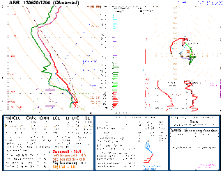
The students know what a cap bust is now

Iowa.  My old nemesis.

You won again, with your cap bust for a cause we can't really ascertain.

I will miss your crazy mugginess and your perplexing refusal to produce a storm, despite the fact that CIN was pretty much gone.


I have yet to see a good storm in Iowa, and that streak continues.

Some day, Iowa.  Some day.

Monday, June 24, 2013

Monday chasing is done

Remember that storm that we were going to go after?  Well, it turns out that, as it was moving into better air, it decided to dissipate.

Makes sense to me.

Monday Monday

So after a lot of trying to figure out where storms would go, while we were sitting in Rapid City, a storm finally decided to go and look mean and nasty near Pine Ridge, SD.  As I write this, it looks like a line segment heading east, albeit not too quickly.  Backed winds ahead of the storm make me wonder whether it's a wind maker or a potential inflow-dominant storm.  We will see as we get closer.

Sunday, June 23, 2013

2013 chase course: the first three days

What a few days!

We started on Friday morning, bright and early--6 AM departure.  We made our way to Watertown, SD, and decided to go west and south, as the warm front was nearby and storms were imminent.  Speaking of imminent, we had our eyes on a storm that was well to our southwest, south of I-90, that was moving steadily eastward with no seeming reason for it to stop.

And yet it did.  It turned into a rather blobby messy area, which made our decision to play farther north easy.  And it became a good decision.  Storms were ingesting good unstable air there, and the shear was better, especially down low.

We got in front of a fairly good storm that was showing some rotation, albeit not huge.  It began to surge a little bit, so we moved east. Another stop showed us that this storm was surging for good, so we decided to play with a storm to our southwest.  It looked like we were going to stay ahead of it, but it, too, decided to surge.  The difference this time was that the surge was the RFD blasting forward, occluding the suddenly stronger mesocyclone.  And to make matters worse, this was happening to our south.

We began to see what we thought were gustnadoes here and there, and another one to our south produced a power flash.  Then we saw, through the murky rain, a funnel emerge from the clouds and make contact with the ground, kicking up some dust.  Let me add right here that it was about 3 PM and it was so dark it looked more like 10 PM.  Anyhow, the road wound around a little bit, though, and we couldn't keep ahead of it.  So as an escape route, 3 of the 4 vehicles decided to take off on a north option.  That ended quickly when it became apparent, through RADAR, that we were going to drive into another circulation.  So.  Drive north into a circulation, drive south into one, or stay put and hope the RADAR was right, that we were between the two.

Good call.

As we sat there riding it out, there were pieces of tree (leaves and small branches) coming down around us, and I estimate that the wind was 60 to 70 mph.  But it was coming from the west, so I was fairly confident we were okay.  Which, it ended up, we were.

Now let's talk about the last vehicle.

When we were driving east to get ahead of the circulation, they got stuck behind us in a rain curtain, and they didn't know where we had gotten to.  So instead of going north, they pressed on east, to the town of Erwin.  They came upon some fallen trees, so they had to go more slowly.  They were navigating through trees and branches in town and the wind really picked up.  This spooked them and they decided to stop.  Good thing: just in front of them, and we're talking inches here, a tree came down.

They decided to take what shelter they could, and parked on the lee side of a church.  That's where we found them about 10 minutes later.

The whole complex turned into a line, and just like that, we were done chasing--and it was only about 4 PM.

That evening we saw the CoD people at the same place we were having dinner, in Sioux Falls, SD.  They showed us their usual Chicago hospitality.

Day 2 dawned with uncertainty galore--and that's usually a sign that storms are a nebulous prospect.  When all signs point to a location rather clearly, it's usually a much better chase day.

We finally decided to play somewhere in central Nebraska-ish.  The ingredients were lining up there, so we figured why not.  During the afternoon, an area of convergence decided to show itself as an area of agitated cumuli near Lexington.  We decided to target that, as it was along a composite outflow boundary/front.  It looked agitated, then got flat again, and then agitated again.  Finally the returns started to show up on RADAR, as the now-storm was up to about 50,000 feet.  Good deal.

It looked multicellular and/or supercell with many splits.  When we got there, it had a fairly well-defined updraft base separate from the rain and hail.

And then it died.  It didn't even go quickly.  It went from a somewhat promising cell to nothing in the span of 20 minutes.

Stopped by the side of the road, we met up with the CoD crew and chatted for a while.

Bed that night was in Kearney, NE.

Day 3, today, was a day that, while better-defined than yesterday, was still a little questionable.  The play was the front range near Denver and then northeast Colorado.

After lunch in Fort Morgan--yum! at Acapulco Bay, we got to this small town about 20 miles northeast of the mile high city, and a storm graced us with its presence.  It was looking okay, almost a left-mover.  So we repositioned to get to a better vantage point.  We got to a good lookout point, and watched the storm rumble and put out some occasional positive strikes, one of which caused a fire, before it decayed.  Lucky for us, though, a storm to its southwest, near Denver, started to look better on RADAR.  So we went to see it and, yeah, not bad, but it was outflowy.  Bummer.  But since there was nothing else to look at, we decided to stay, and we were rewarded with the storm actually trying to become surface-based.  It developed a wall cloud of sorts, and soon it had us wondering if it would soon produce.

We stopped a couple of times to photograph the storm, and during one of the repositioning moves, a tornado warning went out for the storm.  I could understand, as it had become based nearly at the surface, unlike all the elevated storms we had seen previously.

It produced one brief funnel cloud before it, too, fell apart.  After some waiting to see what a storm to our southwest would do, we decided to head back to the hotel.

Along the way, south of Akron, we were racing against time to make it north before the now bow echo did, as it had inside it a report of golf ball hail.

And that brings us to now.  We did make it ahead of the storm and, while RADAR indicated that it was a close call, I don't think we were as close to it as all that.

One note about the chase thus far: on Friday we made some mistakes.  We should have stayed farther away from the storm, with more escape routes.  You can bet that this is something I won't be messing up on anytime soon.  We take pride in being a safe chase group and we just shouldn't have put ourselves in that position.

Anyhow, the next 2 days look quite interesting.  Keep following along on our chase tracker, and hopefully we'll have more interesting tweets and blog entries there.

Thursday, June 20, 2013

The last first-day forecast for U of M chase 2013

Very little has changed.  As a result, I won't post more images that are practically identical to the ones I posted before.

For tomorrow, there are two plays in there, one in southwest SD and one in southeast SD.  The NAM and the GFS don't quite agree; the former favours southeast and the latter, the southwest.  The 4 km WRF is blasting a huge MCS through southern Manitoba (including Winnipeg) and the Dakotas this evening, laying out an outflow boundary.  However, it only breaks out storms in western SD tomorrow evening.  This potential MCS and its boundary will be a thing to watch over the next day or so.

So that's it for forecasting day one.  It's a toss up, still, between western SD and eastern SD.  I guess that this means we'll be leaving early in the morning.

As for the rest of the trip, it's an ever-changing situation.  The GFS, ECMWF and GEM-GLB don't agree at all after about Sunday, so it could be a case of a) staying in the eastern plains for a week, b) going to the western Dakotas for Monday, c) going to Alberta/Saskatchewan for Tuesday, d) bouncing back and forth between the western Dakotas and the eastern Dakotas, or e) having nothing to chase at all after Tuesday.  Frankly, it appears to me that e) is highly unlikely, and if I were a betting man I'd bet on d).

For those of you following along virtually, here's our tracker page again.

http://umanitoba.ca/environment/envirogeog/weather/tracker/

Hopefully, time and sleep permitting, there'll be lots of tweeting from the road and more in-depth blogging throughout the upcoming week.

Chase on!

It's up and working!

So, with a little (LOT) of help from a couple of people, we now have something extraordinarily cool to help your friends and family follow along.

Years ago, when we started this course, we borrowed the idea from the College of DuPage. The course has grown from there and now we have much more equiment to help us nowcast, but now is the first time that we have a webpage where your friends and family can follow our every move, pretty much live, alongside our tweets, which will contain our thoughts and some pictures from time to time.

Many many thanks go to Evan Anderson at CoD for providing lots of technical support and advice, as well as the base code to use, as well as to Rose Sengenberger at the U of M for making the whole thing work on our end.  The result, I must say, is pretty awesome.  Right now it's just showing the most recent location I uploaded (south Winnipeg), but it'll be updating almost as soon as we're on the road.

Here's the URL:

http://umanitoba.ca/environment/envirogeog/weather/tracker/

Enjoy!

The penultimate first-day forecast of 2013

Wow, tomorrow's going to be interesting, to say the least.  Even at this timeframe, it's unclear as to what will happen.

As we saw in the previous post, all the ingredients are seemingly in place.  It's just going to be a matter of where and when storms go, and there's a large distance between potential areas.  Fortunately for us, we will be able to figure all this out by tomorrow.

Here's the NAM valid Friday evening at 7 PM (which is Saturday at 00Z).

The forecast soundings are, respectively, in southeast SD and southwest SD.


 So it's going to be an analysis-heavy day.  On the road.  Oh joy.

The two weaknesses I see in things are a) there's not very good upper-level (250 mb) wind and b) there's not a tremendous amount of capping.  The 250 wind weakness means that storms, although they will be sheared (and with the amount of shear, supercells), they will likely be high precipitation (HP) monsters.  These storms are among the most dangerous to chase, so we will be very respectful of them.  The reason this will likely promote HP monsters is because the lack of upper winds will mean that the precipitation will fall closer to the updraft than we would like for a classic supercell.  The air the storm will be ingesting won't be purely moisture-and-heat-laden air from the warm sector, but rather the above modified by rain-cooled and -moistened air from the nearby downdraft.  Storms will thus have extremely heavy rain and likely large to very large hail, especially given the steep lapse rates on both forecast soundings (indicative of large vertical accelerations within the cloud, able to sustain large hail).  The hail I can see happening is 2 to 3 inches in diameter.  Yes, that large.  So we will stay a respectful distance.  Tornadoes can and often do happen with HP supercells, although they're often rain-wrapped or quickly become so.  Regardless, it looks like some pretty meaty storms are on tap tomorrow.  It's just a matter of figuring out where.  The second thing of concern, albeit lesser concern, is the lack of a cap.  This is something the models are painting that I don't quite believe.  The models kind of suck at some stuff, and that includes gentle subsidence.  So while there's no cap being portrayed, I suspect that deep moist convection will hold off until later in the day.

The good news is that Saturday looks to be a great setup, almost in the same area, so we will be able to do more analysis and *much* less driving.  Hopefully that's a theme that stays through the rest of the trip.


Let's get going!

So this morning and early this afternoon I'm planning to blog in 3 parts: first, with analyses showing how ingredients are now; second, with a model-based forecast for tomorrow; and third, with a model-based forecast based on the 12Z runs, including a convection-allowing model.

Here goes.

Moisture is nicely in place this morning, as this surface pressure and dewpoint chart shows:

As well, a representative sounding of the airmass we'll be playing in for a couple of days is here, also showing plenty of low-level moisture:

Here's a sounding showing what the upstream winds look like:

So all of the ingredients are there and won't likely be moving anytime soon.  In fact, as I'll show in my next blog post, model forecasts and the SPC outlook indicate a better than average chance for supercells in our region of interest on at least Friday and Saturday, with disagreement amongst the models after that.

As a side note, the 8 AM SPC outlook for today has a 5% tornado risk and a 30% hatched hail risk that necessarily extends into the Red River Valley.  The warm front, as we can see from the temperature/dewpoint map above, is somewhere in North Dakota--favourable for a) low-level wind shear if storms go in the daytime, and b) favourable for severe nocturnal thunderstorms here in Winnipeg.

Too bad I can't chase today.

Wednesday, June 19, 2013

Forecast will be up tomorrow

I won't be doing a forecast tonight, but I will do one tomorrow--based on both the 00Z and 12Z runs.  This forecast will be a more in-depth one, and one that will strongly affect where we go Friday and thereafter. 

Also, the special something that I've promised is in its last stages of development, and should be ready sometime tomorrow.  Keep your fingers crossed.

Tuesday, June 18, 2013

Forecasts for the trip!

So I'm back from a few weeks of on and off chasing, and ... well, I'll tell you the stories, but suffice to say that I'm still wanting to do tons more chasing this year.

In past years, I had some super-long-range forecasts based on the different models, as far out as 10 days in advance.  I won't be doing that this year (or, more properly put, I haven't done that this year), primarily because I was out on the road and super busy, but also because it always yields the same results.

If you want to see how it's turned out in the past, check out this link.

In a nutshell, though, Pat, John, Jay and I have been perusing the models for a week or more, and it's the same story: wild variation.

In fact, there's even some pretty big variation as to how Friday is going to turn out.

Which is where I'll begin.  I'll list the models that are available.

Friday:
NAM: central or SE SD
GFS: SE ND
ECMWF: NW SD or SW ND
GEM-GLB: NW SD or SW ND

Saturday:
GFS: SD
ECMWF: E WY or western SD/NE
GEM-GLB: SW MB

Sunday:
GFS: NC KS or S MB
ECMWF: reposition
GEM-GLB: reposition

Monday:
GFS: C SD
ECMWF: NW NE
GEM-GLB: E ND

Tuesday:
GFS: C ND
GEM-GLB: NC SD

Wednesday:
GFS: SK
GEM-GLB: reposition

So as it sits, it looks like we'll start off with a few pretty good chase days, then i becomes unclear what'll happen. Previous runs of the GFS had us in a storm chasers' flow for a week.  Perhaps that'll happen, perhaps not.

On a final note, I've got something in the works that should be up and running tomorrow or the next day, something that will add a real "cool" factor to the trip for your friends and family following along at home.  I'll announce it as soon as it's ready.

Thursday, June 06, 2013

Storm chase with CoD

So tomorrow I will be embarking on a chase with CoD.  I'll likely be tweeting and blogging, but I'm not sure which account or accounts I'll be using.  Here are the possible ones:

Blogs:
http://daveandjustinweather.blogspot.com/
http://wxcentral.blogspot.com/

Twitter:
https://twitter.com/StormStructure
https://twitter.com/cod_stormchase

It looks like Saturday will be a chase day, either in Kansas or Nebraska. Long-range models indicate that most days should be chaseable days, too.

(cross-posted at Dave and Justin Debate the Weather)