The penultimate first-day forecast of 2013
Wow, tomorrow's going to be interesting, to say the least. Even at this timeframe, it's unclear as to what will happen.
As we saw in the previous post, all the ingredients are seemingly in place. It's just going to be a matter of where and when storms go, and there's a large distance between potential areas. Fortunately for us, we will be able to figure all this out by tomorrow.
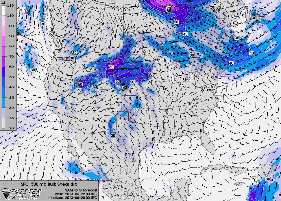
Here's the NAM valid Friday evening at 7 PM (which is Saturday at 00Z).


So it's going to be an analysis-heavy day. On the road. Oh joy.
The two weaknesses I see in things are a) there's not very good upper-level (250 mb) wind and b) there's not a tremendous amount of capping. The 250 wind weakness means that storms, although they will be sheared (and with the amount of shear, supercells), they will likely be high precipitation (HP) monsters. These storms are among the most dangerous to chase, so we will be very respectful of them. The reason this will likely promote HP monsters is because the lack of upper winds will mean that the precipitation will fall closer to the updraft than we would like for a classic supercell. The air the storm will be ingesting won't be purely moisture-and-heat-laden air from the warm sector, but rather the above modified by rain-cooled and -moistened air from the nearby downdraft. Storms will thus have extremely heavy rain and likely large to very large hail, especially given the steep lapse rates on both forecast soundings (indicative of large vertical accelerations within the cloud, able to sustain large hail). The hail I can see happening is 2 to 3 inches in diameter. Yes, that large. So we will stay a respectful distance. Tornadoes can and often do happen with HP supercells, although they're often rain-wrapped or quickly become so. Regardless, it looks like some pretty meaty storms are on tap tomorrow. It's just a matter of figuring out where. The second thing of concern, albeit lesser concern, is the lack of a cap. This is something the models are painting that I don't quite believe. The models kind of suck at some stuff, and that includes gentle subsidence. So while there's no cap being portrayed, I suspect that deep moist convection will hold off until later in the day.
The good news is that Saturday looks to be a great setup, almost in the same area, so we will be able to do more analysis and *much* less driving. Hopefully that's a theme that stays through the rest of the trip.
posted by Dave "storm structure" Carlsen @ 9:26 AM
0 comments
![]()


0 Comments:
Post a Comment
<< Home