Tuesday, July 28, 2009

Time lapse videos

So I finally got around to posting some videos.
Both of these videos are amalgams of pictures taken on a tripod, about 10 seconds apart.

The first one is of the left-moving, anticyclonically-rotating supercell we caught in Wyoming.
Here's the video

The second is of the LP-looking storm we caught in Texas.
Here's the video

Enjoy!

Monday, July 20, 2009

Day 10: back to CoD

This was pretty much strictly a travel day, as we had a long haul in front of us--from Wichita, KS to Glen Ellyn, IL. About 11 hours.

We stopped for lunch in Kansas City, at a bbq place called Rosedale BBQ. It was pretty darn good; I had the burnt ends and then Paul and I shared a ham sandwich. Nice!

On the way back we were watching severe weather unfold, as we forecast, in eastern Saskatchewan and western Manitoba. If only the trip had been a day longer...

Here are a few pictures from day 9's chase. I'm so tired.


Sunday, July 19, 2009

Day 9: Wichita, KS

We weren't sure we'd be chasing today at all, but here we are, in Wichita, after chasing. We weren't feeling at all great because of the brutal hotel last night--it stayed hot all night despite the cranked air conditioning, some of the toilets didn't flush properly and some of the showers didn't drain properly. The "swimming pool" was an under-construction mess that looked really creepy at night, and the reception at the desk in the morning when confronted with these problems was not courteous.

I will not be staying at the Lubbock in ever again. Neither will anyone on the trip.

Anyhow, after getting out of there, most of us with 2 or 3 hours' sleep (although me being the only one used to it on this trip), we stopped at IHOP in Plainview--both to get some coffee and to clear our minds to think. We looked at information and decided that the risk for good storms was high enough to stick around for most of the day.

And boy, were we rewarded.

We got a supercell pretty much right from initiation in the Oklahoma panhandle and followed it, as well as a sister to it to the northwest, for the better part of 4 hours. The main one had, at times, a great RADAR presentation. However, the northwest one looked very beautiful, pretty LP-ish. Anyhow, we were getting close to the time we had to leave and so we delayed moving for a bit; our decision was quickly made for us as we all had to pile into the vans in a hurry--big hail began to fall. A lot of quarters and loonies; there were some golf balls and maybe some baseballs, too; I wasn't confident enough in that, though, so the report we made was of golf balls.

We are in Wichita, KS and we will be back in the Chicago area tomorrow evening. Pictures won't be forthcoming tonight, sorry, because I didn't sleep well last night and that bed is calling my name.

Pictures will be on their way, however.

Good night.

Saturday, July 18, 2009

Day 8: Lubbock, Texas

We got up this morning and anticipated storm initiation in southeast Colorado mid-afternoon. Well, after stopping in Dalhart for lunch, we saw storms initiating to the northwest. In New Mexico. So we went: my first time ever in that state! :)

The storm had, at times, okay rotation on RADAR and visually, but it decided to give it up after a while. So we went to another storm that was percolating to its northwest.
We got there and the storm had amazing supercell structure. It showed some good rotation for quite a while but eventually died out. Here's a picture of what it looked like:


Another storm was going pretty hard near Amarillo, so we went for it. It looked okay when we got there, but it was definitely outflow-y. Still a supercell, at least based on RADAR.

Which took us to Lubbock - and Cagle Steaks. Best. Ribeye. Ever.

We then came here to our hotel--or should I say our fleabag hotel. It is more or less clean, but lacks enough towels and the rooms are about 400 degrees, but to be fair the air conditioning works just fine.

A nice day, all in all. We actually got 3 supercells and steaks at Cagle's. In July.

FYI, this chase trip is the farthest south, by a long shot, CoD has gone on a trip 5.

Thursday, July 16, 2009

Day 7: Borger, TX (yes, Texas!)

The day started off with a lot of uncertainty but some optimism that we would see some good storms in southwest Kansas.

Until the MCS decided to blow up in Nebraska and send an outflow boundary southward. This outflow ended up blasting southward to sit from about Oklahoma City to Dodge City by mid-afternoon. Our trip out west was therefore uncertain, as the outflow didn't seem to want to stop, and thus instability was uncertain.

Well, after a great BBQ lunch in Wichita, KS (Hog Wild Pit BBQ, and the elderly woman whose job was clearing the tables was so incredibly nice), we kept going west toward Dodge City, where if there would be no storms, we would at least be in place for tomorrow's chase.

Well, on the way, it turns out some storms fired off on the outflow boundary, but they didn't have a whole bunch of shear. So they exhibited multicell characteristics, maybe occasionally supercell (a split) and then one storm seemed to take over a bit; at times the RADAR presentation of it was quite good (nice meso, inflow notch) and at those same times it looked better in real life.


Oh yeah, did I mention that by this time we were in Texas? For CoD, not even close to the first time, but for me, yes.

As predicted

We went to KC and Jess and Jim's. Mmmmmmm.
Tomorrow looks not too bad in west-central Kansas, and the next day after that in eastern Colorado.

Keep your fingers crossed!

Wednesday, July 15, 2009

Day 5: some multicells and the highest point in Iowa

Yesterday was hyped up to be a better day than it ended up being, for us at least, by a long shot.

Storms were certain to develop, but because of a) linear forcing (i.e. a cold front) and b) veering winds near said front, the low-level shear wasn't enough to keep them very organized. We worked hard even to get what we got, which was some multicell structure that at times exhibited a little more organization.

During the day, we happened by the highest point in Iowa (actually we didn't see the plaque, so we weren't quite at the highest point--I didn't know the plaque was there, and nothing else looked any higher) so that was a point of interest. Modest interest. ;)

No chasing today--it's a pretty dead day. We're going to Jess and Jim's for steaks and play central Kansas tomorrow.

Tuesday, July 14, 2009

Day 4: big supercell day to Grand Island, NE

We started off this morning with a target of Belle Fourche, SD in mind. We got to lunch in Newcastle, SD and saw towers going up to the northeast of us--in a pretty favourable area. We looked at the situation and they issued a tornado watch, so we took off eastward. So goes chasing.

The ride through the Black Hills was interesting. There was a lot of nausea in the back, although nobody had to pull over to un-eat lunch. After we finally got through Rapid City, we got close to a now-tornado-warned supercell near Wall (go to Wall Drug). It showed some okay rotation and lowering so we decided to stay on it.

During a gas stop the rotation tightened up considerably and the storm looked like it might drop a tornado. It didn't, but it augured well for us.

To make a long story short, we chased the tornado-warned supercell for about 8 hours, sometimes with big rotation and lowerings, sometimes with less rotation (at least down low).

A couple of times we stopped to watch the storm ingesting huge amounts of air, evidenced by the 30 to 35 knot inflow winds that kicked up some dust in a series of fields, giving us brief bouts of zero visibility. Seriously zero.

The storm took us to Valentine, NE, where we gassed up quickly and picked up a meal on the go ("meal" is being generous with the kind of foods one often eats on the road) and went southeast. The storm was looking okay but potentially polluted by another storm to its south, so we made the decision to keep going southeast instead of south at a junction.

Bad move.

The storm ingested the new updraft and blew up into a huge HP supercell that looked AMAZING on RADAR. After one false start (almost having to push the vans out of the mud) we got onto a road that took us east toward the storm. It wended its way through a bunch of ranches and splashing through some pretty deep pools of water, and got us to the highway.

Where the mothership was waiting for us.

You talk about it in class and see pictures of it, but until you see a mothership supercell in person, you don't really understand what it's all about. The inflow into the storm from the east was incredible; we estimate 50 to 60 mph, and, naturally, being in the Nebraska sand hills we all got sandblasted. The striations on the mid-level rotation were a delight. Here's a picture; it's a good one, but it doesn't even do justice to what we were seeing.


Or here's a pseudo-HDR version:


It finally got dark and so we got a few lightning pictures, and that's the end of that day. A pretty good day, all around, even though our initial forecast target area apparently got a big tornado today.

Whatever. We saw an amazing super long-lived supercell, and the prospects for tomorrow, pending MCS pollution tonight, are great.

Monday, July 13, 2009

Day 3: Lusk, WY

We started off the morning with little in the way of expectations--the pattern looked almost the same as the previous day. So we decided to take our time and, first things being first, get some lunch at The Stone Ridge Grille at the Mariana Butte Golf Course in Loveland, CO. In addition to an omelet station, they had prime rib. Sweet.

After a great lunch we drifted north and intercepted a weak storm that was crossing a boundary (outflow?) south of Cheyenne. It died and we kept going. Finally we got a storm northeast of Wheatland, WY that had a funny look to it. It kind of looked like a supercell, except the updraft base was on the north side of the storm. Why would that be? Turns out it was an anticyclonic supercell. Here's the picture to show what it looked like:


After that storm died we took off to another storm, this one a weakly-rotating long-lived storm about 60 miles to our northwest. After being slowed by a great big convoy (begin singing in your head; I can wait) of army vehicles, we made it to the storm just in time for another storm to poop out an outflow and interfere with it.

Ah well.

We came to Lusk only to find out that the only eatery open on a Sunday night here is Subway. The young woman dealt with our sudden influx of people with grace. I was impressed.

The new SPC day 1 is out and it's got the main area right where we've been looking the past few days--NW SD-ish. It's time for me to go to bed so that I can analyze things properly in the morning and get us to the right area.

Good night.

Sunday, July 12, 2009

Day 2: Greeley, CO

Yesterday was as clear as mud. There was little in the way of obvious focused forcing and so storms could have gone up anywhere in a huge area. We ended up playing the cumulus field in the Nebraska panhandle until they didn't go any higher, at which time we took off to a decent-looking storm in northern Colorado. One that was moving toward the north. We figured, okay, it's moving north now so when it takes a right turn we'll be in business.

That didn't happen.

Another set of storms went up in a hurry to this storm's southeast, and they looked good both visually and on RADAR--from what we could see. We got somewhat close until the hail started. It came down as dimes and nickels and then got to slightly bigger than quarters. We hauled it out of there when the hail appeared it was going to get even bigger--no need to lose a windshield.

After we got away from that storm it decided to fizzle anyhow.

Farther west there were some storms going up that looked pretty good and wouldn't have their inflow polluted, so we took off in that direction and took a look. Meh.

After that we had had enough and went to the hotel in Greeley, CO.

On the way into Greeley we saw why the storms weren't behaving as expected: the hodograph from the 00Z Denver sounding was almost exactly the opposite of what you'd look for with a right-moving supercell. Well, that and the speeds weren't as good. So what we saw, storms moving north and the inflow on the north sides of the storms, was well-explained with that. Oh and no storm ever exhibited rotation, so all we got was a couple of multicell storms.

Yes, large hail from a multicell. In fact, there was a credible report of 2" (50 mm) hail from the storm we abandoned. Why would that be? Steep lapse rates. Even though storms weren't persisting, they were lasting long enough and were ingesting enough moisture to produce large, hard ice cubes.

Today looks very similar to today, and then things look to be on the upswing for a couple of days.

Saturday, July 11, 2009

Northwest Ontario tornado

On another note, the first deadly tornado in Canada in 3 years occurred the other day. It was somewhere in the forested area of northwestern Ontario. The video, in a likely time-sensitive link, is at this link. According to my sources, it looked classic on RADAR.

It's a tragedy to have people killed in a tornado. Although I love to watch them, I (and most, probably all) people I know never. Ever. Want to see anyone hurt by them. This, in part, is why we chase--aside from the aesthetic beauty of a storm, we're there to help warn of impending danger. It's what we do.

Some servers down, and I need to have a better brain

Some of the weather servers are down all across North America. Data feeds are not working; technicians are on the problem, but we may not have analysis maps this morning.

And last night, when we got into town I realized that I had left my toothpaste, toothbrush and stuff like that back in Chicago. No problem--I would just have to find a store to buy some replacement stuff.

I went to the store, picked up what I needed, came back, had a swim (it's good to get your move on on a trip like this, even if it is for a half hour or so), brushed, flossed (Dr. Harris would be proud) and went to bed. This morning I got up and took my bag into the bathroom, and found the stuff that I had left in Chicago. I had packed it in a side pocket, unlike anything I would ever do in my prior packing style. So now I have three toothbrushes, 2 things of floss, and many other doubles in my bag. It's okay--it's not like floss goes bad.

Chalk it up to being tired yesterday?

Friday, July 10, 2009

Day 1: Lincoln, NE

We went west, then south, back north and west. We broke out into the sun west of Des Moines after an MCS screwed up the atmosphere for us. Past Omaha and into Lincoln, with nary a storm in sight.

We went for dinner at Skeeter Barnes, where I had what ties for the best prime rib I've ever had. Ever. And alongside it was served some really awesome coleslaw--dressed with peanuts and a sesame dressing.

Tomorrow looks not too bad, but with conditions. We'll see more clearly in the morning here we might go.

Clear as mud

We're sitting in the lab, trying to figure out where to go. There's an MCS blasting across Iowa, and it could end up polluting the atmosphere but hopefully leaving an outflow boundary. We should head toward the Quad Cities and see if things clarify from there.

Thursday, July 09, 2009

In Chicago, ready to go

This evening we have the preparation class and then it's off tomorrow to actually chase. Right now there seem to be about 3 targets: eastern Iowa/western Illinois, north of Omaha, and far western Nebraska. Which one will it be?

Wednesday, July 08, 2009

A new trip

As you may or may not know, I'll be going with the College of DuPage on their trip 5, which leaves Friday. They've hired me on to be the forecaster assistant, which means I'll be doing much of what I was doing on the U of M trip without the driving.

I'll keep you posted here as to what we see and where we are.

So long as we're in the US (a likely prospect for most of the trip, at this point) we will have the GPS tracker on. Check it out at this link:
CoD chase tracker

Or to see all the chasers' locations (well, those who broadcast their locations) check here:
Spotter network

Sunday, July 05, 2009

Pictures up

I have gone through the pictures and posted some of them; I'm not overwhelming the site with too many, but a good mix of what we saw and experienced. Including the small Canada Day celebration we had in South Dakota that I had forgotten to mention. Or the few pics from the Pizza Ranch in Spearfish where the manager re-opened the place just for us.

The link is here.

Pictures soon

I'm slowly working through the pictures from the trip. All 3180 of them. And I'm still missing a lot of them. But hopefully I'll have them organized into days and post them on the photobucket account tomorrow.

I'm still recovering.

Saturday, July 04, 2009

In Topeka, sorry for the lack of a post last night

We were in a tornado watch yesterday. The warm front play was our only play, really, and we got to the right place in time, just south of the front and east of the surface low.

And then storms blew up in the warm sector to our south. What?

They were forming in air that had T/Td of 38/16, so they were very high-based. Moving northeast, they would hopefully favourably interact with the warm front, so we got ahead of one (dodging between hail cores) and saw the updraft base evolve from a squall-looking thing to a supercell stack-of-plates or donut updraft. Yes, pictures to come. The things didn't seem to want to take off in the boundary layer, or not completely, or maybe they didn't ingest the shear properly or maybe even the moisture--we'll discuss that today. Whatever the reason, they didn't really get going until nightfall, when Doppler-warned storms popped up, and yes, we were on the right ones. A couple had some pretty interesting looks, maybe some rotation from time to time, but they were mainly outflow-dominant.

We went to the IHOP in Junction City for dinner, where the storms caught up with us and gave us a wicked light show, then we had about an hour's drive to Topeka where, along the way, we were treated to another great light show.

I went out for a walk in the rain when we got in, and it was about 22 degrees. Very warm rain. Beautiful.

Now it's time to take off, and I think we're going back to Winnipeg, but we will be back fairly late--midnight is my guess. I will gather pictures along the way and hopefully post them within a day or 2.

Friday, July 03, 2009

The world's longest driveway, aka the road to nowhere

We started off in Spearfish again, targeting Chadron, NE. Storms once again went early, and we ended up going after a pretty nice outflow-dominant severe-warned storm northeast of Hot Springs, SD. We got some pictures and then got together for some data, and we took off to the south.

That's where things got fun. The storm had kicked out an outflow that was blasting eastward quickly, almost keeping ahead of us; we did finally get to a storm in the good air, but we were on the wrong side of it; the Nebraska sand hills aren't good for roads, either, so we had to go farther east than we wanted. We finally got a road south--something sort of sketchily named like Road 16-spur, but our GPSs and maps indicated that it was a good road.

Along the way, the storm decided to look STUPID good! Some called the partially-obscured wall cloud the "foot of God". Not that that region would have much to stomp.

Getting there:
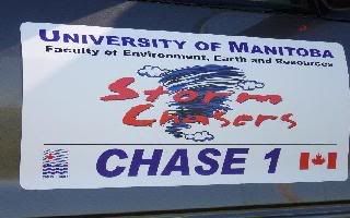
After going through the national forest and getting onto "better" roads, we crossed a cattleguard and sloshed on some gravel/dirt. Where there were cattle. Chase 1 had to stop, idle for a bit, and even honk. The cattle (a mother and her calf) looked at the van indignantly until the second honk, when they finally looked with contempt at the vans. Then banging on the windshield finally got them moving and got out of the way. The calf took off down the road; not off the road, but down the road. And then eventually went. Oh, did I fail to mention that we passed not one, but 2 slow-moving (VERY slow-moving) vehicles on the way? So when we got close to the highway we were seeking, the road ended. I'm not kidding. It just ended. No fanfare, no signs, no nothing; just a house there and befuddled people wondering what the heck 4 vans full of people and festooned in antennae was doing in their driveway. Their driveway, for heaven's sake! We just drove about 30 miles along what was essentially a driveway for 4 houses. The second vehicle we had passed eventually came along and told Chase 3 how he knew he'd be seeing us again, chuckling to himself.

By this time, the storm started to die and nothing else was worth chasing.

We went to Valentine, where we are having an ... ahem ... unwinding party, for the night.

We're all in good spirits because that's a really great story, the kind of story we're going to remember for a long time.

Well, that and the fact that tomorrow looks pretty good. Here's hoping. Target (right now): HA, you thought I'd give it up?!

Thursday, July 02, 2009

A picture


From Tuesday's chase. More will be coming after we're done--looks like too much driving to be able to post more here.

Nice, eh?

Canada Day chase

So it was another day of sitting and waiting for things to go. We sat at a gas station south of Rapid City, waited for more certain information and when it did, we went. Storms were obviously wanting to go over the Black Hills, but would they go farther?

An area of enhanced cumuli formed south of the Hills, and we decided to go take a closer look. As we approached, a storm fired and it was just north of us, moving straight south. Well, if you've ever seen a map of the area, the roads are few and far between. So we got caught, and hailed on (and dented) for our troubles. Knowing that there was sizable hail in the storm, we opted to take the only safe route--west into Wyoming and then south and east into Nebraska. All the way there the storm was looking better and better--getting taller and the inflow kept lowering. And when we got within 10 miles of it, it died. Quickly.

GAAAAH!

Tomorrow looks about as certain as today did, maybe with slightly better wind fields, but it could be a large area. The next day, however, is rife with interesting possibilities. Southeastern Nebraska, anyone?

I've been asked about pictures. They will come. There has just been so much driving that posting them has been next to impossible. But they will appear.

Wednesday, July 01, 2009

Happy Canada Day, and more uncertainty

Today we're going to see Mount Rushmore and then do a data/lunch stop in Rapid City. It seems the 2 areas are the Black Hills (magic) and the NE/SD border south thereof. The ingredients aren't great, but this place seems to have some magic attached to it.

On another note, southeastern SK will go pretty big, I think (again). Wxdog mentioned (quite rightly) that we would have done well to sit in Weyburn for 3 days. Hindsight, and all that.

Happy Canada Day!

Day 2: good storms, including a spectacular supercell

We got initiation to the north and west of Glendive. A storm seemed to be taking over to the NW so we took off in that direction--sort of. We ended up taking a road that ran NE-SW. The storm got tornado-warned (trained spotters, funnel cloud, I really doubt it) and then it kind of got absorbed.

A bunch of storms decided to fire off, and the main one seemed to take over. Where was it? Just east of Glendive. D'oh!

So we went back to GDV, dodging some sizable (nickel) hail, and then got stuck behind the now-tornado-warned storm because ThreatNet showed it was putting down some huge hail. We eventually got to the other side and observed a pretty good updraft base from a closed weigh scale. It eventually pooped out and we had to go east.

We did a pit stop east of Dickinson, and the storms (rather inconveniently) were at that time in a RADAR dead zone. Well, mostly--there are actually a couple of hail suppression RADARs out in western ND, but they don't get ingested into ThreatNet so we were essentially blind.

Anyhow, whilst at the pit stop, Chase 1 got a wi-fi signal and saw the storm via the intert00bz, yes I'm tired, and blasted south. Uh, okay, what's going on? We followed them and asked over and over again on the walkie-talkies what they had seen--no answer, until someone in Chase 1 texted us and told us their walkies had died. D'oh!

Well, when we got a good 40 miles south of I-94, we saw why they were in such an almighty hurry-a well-defined wall cloud was off to our southwest, and it looked good. I mean the kind of wall cloud that produces tornadoes good.

I won't keep you in suspense--while we were on it, it never did, but what it did do was give us lots of tantalizing looks at striations, stacked plates and some exquisite colours interspersed while the whole lot of us shutterbugs snapped away. This was by far the best storm the U of M storm chase class has ever intercepted. We kept following it on its SSE course, getting into the inflow air (warm and moist) and then letting ourselves be blasted with outflow (cool and moist, winds about 60 mph). This went on until sunset, when we happened into the town of Buffalo, SD, where we decided we needed to eat. And so we did. Just as we were going into the place to eat (well, most people; I had gone back to the van because I had forgotten something, and some locals stopped me and chatted me up about storms for about 5 minutes) the outflow came through, thoroughly sandblasting everything. I still have some grit in my teeth (yes, I will brush) and my hair.

We're overnighting in Spearfish, SD, just northeast of Rapid City. Tomorrow (well, today, and HAPPY CANADA DAY!) we should be somewhere around here--maybe a bit more south, but the Black Hills will likely have something to say about where we can chase. But we will figure out the details in the morning--analysis saved our hide this morning (was there ever any doubt?) and, if anything will tomorrow and the next day and forevermore, it's analysis. Hand analysis.

Analysis, diagnosis, prognosis. It's amazing when the theory works out so well.