Summary of the day: June 28, 2017
Wednesday was a day with 2 potential locations to chase and another that we knew would light up but wasn't reachable. The two locations were eastern Colorado and southeast Nebraska. Eastern Colorado was a lesser play because the moisture had been flushed, so we opted for the southeast Nebraska play.
We were expecting primarily outflow-dominant supercells because the models had been consistent in veering the winds ahead of the slowly-advancing cold front. But a detail in my H5 analysis gave me hope: there was a subtle thermal ridge/trough couplet over Nebraska that the model hadn't picked up on. So if it would time favourably, perhaps pressures would fall and winds back at the surface, giving us a better tornado chance.
After lunch in York we came outside to see significant towers bubbling up to our east. Visible satellite imagery also showed an area of significant agitation in the cumulus field over the area, so we hurried in that direction. Once we got east of Lincoln, towers were really starting to show great vertical development, and one looked like it had breached the cap near Nebraska City. Soon it became a full-blown storm crossing the Missouri River.
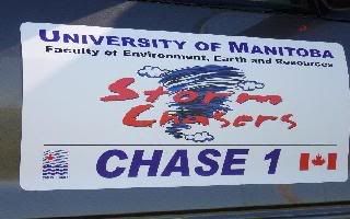
After navigating up the bluffs and through Waubonsie State Park, we came to an opening where we could see that the storm was really ramping up its rotation. We stopped to have a look and, around 3:43 PM, we caught the first tornado of the U of M 2017 storm chase trip!
The storm somewhat disappeared into the terrain so we continued east. The mesocyclone decided to produce a very pretty vortex on its edge. We stopped for more pictures and the storm produced a second tornado for us.
After this, the storm got rather messy with new storms going up and interacting with the existing ones, so we looked to our south. At that point we saw a new updraft rocketing up, with amazing motion on a wall cloud. We were in a weird place relative to the storm, one I don't usually place myself in, northwest of the circulation. No precipitation was on our tail, so we had time. The storm really ramped up its low-level rotation and it had the chance to produce a tornado a couple of times, but it never quite focused the rotation enough. After finding a 2 inch hailstone in the grass, we opted to keep following along with the storm until it got messy because of more interactions.
At this point, there was just a big mess of storms interacting with one another, so we opted to drive back to the hotel. We started out north and saw on the RADAR that we would be going through a nasty hail core, so we doubled back south to get around the complex. Also, RADAR showed that somewhere upwards of 8 inches of rain had fallen there too.
We got south and west, and another storm decided to get strong in front of us--bonus supercell! It showed us a nice wall cloud and a possible tornado, but its main characteristic was that it was throwing out tremendous lightning bolts all over the place, and we got some really good pictures.
We got in late to our hotel in Lincoln, so dinner was a quick grab-and-go along I-29.


0 Comments:
Post a Comment
<< Home